JP
°F
測定値を変更する
Meters
Feet
摂氏
°F
時速キロメートル
時速マイル
ノット
am/pm
24-hour
設定が更新されました
言語を変更する
Deutsch
Español
Italiano
Nederlands
中文
English
Français
日本語
Português
今日
七日間
天気
釣り
海温
United States
潮見表
Virginia
潮見表
Mathews County
潮見表
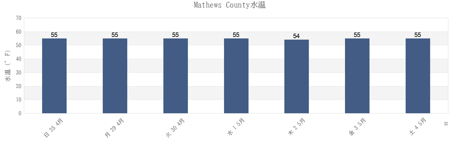
Mathews Countyの海水温
今週のMathews Countyの海の温度
Mathews Countyのより多くの潮汐と海洋情報
今日潮見表
今週潮見表
今週の天気
潮汐表 釣り
Mathews County, Virginia, United Statesの地域
Bethel Beach
Little Creek (Railroad Terminal), Chesapeake Bay
Windmill Point Light
Bland Point Piankatank River
Mathews
Windmill Point Light 2.2 n.mi. ESE of
Cherry Point
Mobjack (East River)
Wolf Trap Light
Gwynn Island
Mobjack East River
Wolf Trap Light 0.5 mile west of
Gwynn Island 1.5 n.mi. east of
New Point Comfort 2.0 n.mi. WSW of
Wolf Trap Light 1.4 n.mi. NNE of
Gwynn Island 8.0 n.mi. east of
New Point Comfort 4.1 n.mi. ESE of
Wolf Trap Light 2.0 n.mi. NW of
他の場所を表示
Horn Harbor Marina
Stingray Point 1.2 n.mi. NE of
Wolf Trap Light 5.2 n.mi. ENE of
Jackson Creek (Deltaville)
Stingray Point 5.5 miles east of
Jackson Creek Deltaville
SW Branch, Severn River, Mobjack Bay
Mathews County
Bethel Beach
Mathews
Wolf Trap Light 2.0 n.mi. NW of
Horn Harbor Marina
Wolf Trap Light 0.5 mile west of
Wolf Trap Light
Wolf Trap Light 1.4 n.mi. NNE of
Mobjack East River
Mobjack (East River)
Gwynn Island 1.5 n.mi. east of