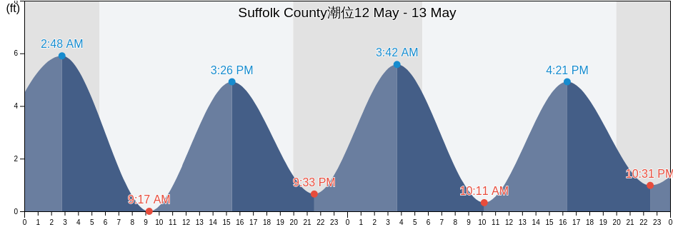
Suffolk County, New York, United States潮位

金曜日 19 4月 2024, 14:23 EDT (GMT -0400). Suffolk Countyは現在引き潮です。潮汐表に見られるように、満潮(5.25ft)は09:07でした。また干潮の0.66ftは03:00でした。 今週のSuffolk County潮見表を見るにはここをクリックしてください.

次の満潮

次の満潮は
21:27

次の干潮

次の干潮は
15:19

Suffolk County満潮干潮

今週Suffolk County潮見表
Suffolk County満潮干潮 日の出と日の入り
1潮 2潮 3潮 4潮
金 1903:00
0.66 ft
09:07
5.25 ft
15:19
0.66 ft
21:27
5.25 ft
06:05 19:36
土 2003:46
0.66 ft
09:51
5.25 ft
16:00
0.66 ft
22:07
5.58 ft
06:03 19:37
日 2104:26
0.33 ft
10:31
5.25 ft
16:38
0.66 ft
22:44
5.58 ft
06:02 19:38
月 2205:05
0 ft
11:08
5.25 ft
17:14
0.33 ft
23:19
5.58 ft
06:00 19:39
火 2305:41
0 ft
11:45
5.25 ft
17:48
0.33 ft
23:53
5.58 ft
05:59 19:40
水 2406:17
0 ft
12:21
5.25 ft
18:23
0.33 ft
05:57 19:41
木 2500:28
5.91 ft
06:54
0 ft
12:58
5.25 ft
18:58
0.66 ft
05:56 19:42

今日Suffolk Countyで釣りに行くのに最適な時期 平均的な釣り日

メジャーフィッシング

から02:04から04:04

反対側の月の通過 (月の北中)

から14:35から16:35

月の通過 (月の南中)

マイナーフィッシング

から03:54から04:54

月の入り

から15:05から16:05

月の出

ここをクリックして、1週間のSuffolk Countyの釣り時間を確認してください.

今のSuffolk Countyの天気

時々曇り

天気

雲量13%
気温

気温

47°F
最低45°F/最高47°F
風

時速14マイル
突風時速21マイル
湿度

湿度

74%
露点39°F

今週のSuffolk Countyの天気を見るにはここをクリックしてください
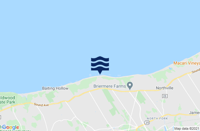
今日のSuffolk County気温

日の出は06:05でした。また日は19:36に沈む予定です。今日の日照時間は13時間と31分です。また今日の平均水温は47°Fです。現在の水温は44°Fです。また平均水温は44°Fです。

今日のSuffolk County天気予報
0 h 3 h 6 h 9 h 12 h 15 h 18 h 21 h 24 h
時々曇り時々曇り時々曇り時々曇り時々曇り時々曇り曇り全天雲n付近所々で雨
45°F47°F46°F47°F47°F47°F46°F47°F47°F

今週のSuffolk Countyの天気を見るにはここをクリックしてください

Suffolk Countyのより多くの潮汐と海洋情報

Suffolk County, New York, United Statesの地域

Acabonack Hbr. ent. 0.6 mile ESE ofHerod Point 6.5 miles north ofPonquoque Point
AmagansettHitherhillsPotunk Point
Amagansett BeachHobart BeachPromised Land
AmityvilleHog Creek Point north ofQuantuck Bay
AquebogueHolbrookRam Island 1.4 miles NNE of
Asharoken BeachHoltsvilleRam Island 2.2 miles east of
BabylonHorton Point 1.4 miles NNW ofRemsenburg-Speonk
Bay ShoreHuntington Bay off East Fort PointRidge
Bay WoodIslandiaRiverhead
BayportIslipRiverside
BellportIslip TerraceRoanoke Point 2 miles NE of
Bellport BayJamesportRoanoke Point 2.3 miles NNW of
Blue PointJennings Point 0.2 mile NNW ofRoanoke Point 5.6 miles north of
BohemiaJessup NeckRobert Moses State Park Boat Basin
BrentwoodKings ParkRobins Island 0.5 mile south of
BridgehamptonLake GroveRocky Point 0.3 mile north of
BrightwatersLake RonkonkomaRocky Point 1 mile east of
BrookhavenLaurelRocky Point 2 miles WNW of
CalvertonLazy PointRonkonkoma
Captree IslandLindenhurstSachem Head 6.2 miles south of
Cedar BeachLittle Peconic BaySag Harbor
Cedar Point 0.2 mile west ofLittle Peconic Bay entranceSand spit
Center MorichesLloyd Harbor (Huntington Bay)Sandspit
CentereachLloyd Harbor entranceSayville
Centerport BeachLloyd Point 1.3 miles NNW ofSeatuck Cove
Central IslipLong Beach Pt. 0.7 mile southwest ofSelden
Coecles HarborLong Island SoundSetauket Harbor
Coecles Harbor Marina and BoatyardManorvilleShagwong Point
Cold Spring HarborMasticShelter Island
CommackMastic BeachShelter Island Heights
CopiagueMattituckShinnecock Bay
CoramMattituck InletShinnecock Bay entrance
Cornfield Point 4 miles south of Buoy CFMattituck Inlet 1 mile northwest ofShinnecock Canal
CupsogueMecox BayShinnecock Hills
CutchogueMedfordShinnecock Inlet (ocean)
Davis Park MarinaMelvilleShinnecock Yacht Club (Penniman Creek)
Deer ParkMiddle IslandShinnecock Yacht Club Penniman Creek
Dix HillsMontaukShirley
Duck Pond Point 3.2 n.mi. NW ofMorichesSix mile Reef 1 mile south of
East FarmingdaleMoriches Coast Guard StationSix Mile Reef 1 mile west of
East HamptonMoriches InletSix Mile Reef 1.5 miles north of
East Hampton BeachMount Sinai HarborSix Mile Reef 2 miles east of
East Hampton NorthNapeague HarborSix Mile Reef 2 miles south of Buoy TE
East IslipNesconsetSmith Point Bridge (Narrow Bay)
East MorichesNew SuffolkSmith Point Bridge Narrow Bay
East PatchogueNorth AmityvilleSmithtown
East QuogueNorth BabylonSmithtown Bay
EastportNorth Bay ShoreSound Beach 2.2 miles north of
Eatons Neck 2.5 miles east ofNorth BellportSouth Jamesport
Eatons Neck 3 miles north ofNorth Great RiverSouthampton
Eatons Neck PointNorth Haven Peninsula north ofSouthold
Eatons Neck Pt. 1.3 miles north ofNorth LindenhurstSprings
Eatons Neck Pt. 1.8 miles west ofNorth PatchogueStony Brook Harbor
Eatons Neck Pt. 2.5 n.mi. NNW ofNorth SeaThreemile Harbor Entrance (Gardiners Bay)
FarmingvilleNorthportThreemile Harbor Entrance Gardiners Bay
Fishers IslandNorthport (Northport Bay)Tiana Bay
FlandersNorthport Bay entrance (in channel)Truman Beach, Long Island Sound
Flanders BayNorthport Bay south of Duck I. BluffTuckahoe
Georgica (East Hampton)NorthvilleUpper Sag Harbor Cove
Georgica PondNorthwest HarborVillage of the Branch
Gilgo BeachNoyackWater Mill
Goff Point 0.4 mile northwest ofNoyack BayWest Babylon
Gordon HeightsOakdaleWest Bay Shore
Great RiverOrient HarborWest Hampton Dunes
GreenportOrient PointWest Islip
Greenport WestOrient Point 1 mile WNW ofWest Sayville
Hammonasset Point 5 miles south ofOrient Point 2.4 miles SSE ofWesthampton
Hampton BaysOutside PonquogueWesthampton Beach
Hashamomuck BeachOverlook BeachWheatley Heights
HauppaugeParadise Point 0.4 mile east ofWyandanch
Herod Point 2.8 miles north ofPatchogueYaphank
Herod Point 5.0 n.mi. NW ofPonquogue bridge Shinnecock Bay