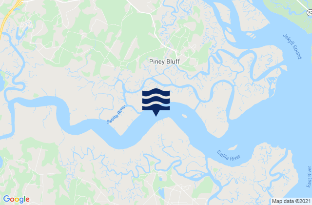
Camden County, Georgia, United States潮位

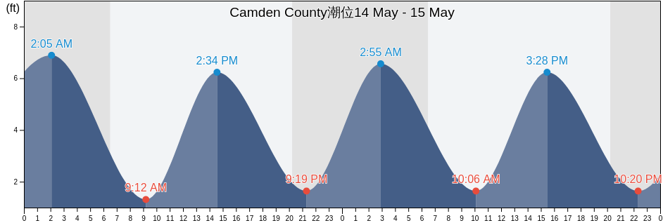
木曜日 25 4月 2024, 07:34 EDT (GMT -0400). Camden Countyは上げ潮です。潮汐表に見られるように、満潮の7.55ftは22:50の予定です。また干潮の0.33ftは05:05でした。 今週のCamden County潮見表を見るにはここをクリックしてください.

次の満潮

次の満潮は
10:27

次の干潮

次の干潮は
16:55

Camden County満潮干潮

今週Camden County潮見表
Camden County満潮干潮 日の出と日の入り
1潮 2潮 3潮 4潮
木 2505:05
0.33 ft
10:27
6.23 ft
16:55
0.33 ft
22:50
7.55 ft
06:47 20:01
金 2605:42
0.33 ft
11:06
6.23 ft
17:31
0.33 ft
23:29
7.22 ft
06:46 20:02
土 2706:23
0.66 ft
11:47
6.23 ft
18:10
0.66 ft
06:45 20:02
日 2800:10
7.22 ft
07:08
0.66 ft
12:31
5.91 ft
18:56
0.66 ft
06:44 20:03
月 2900:57
7.22 ft
08:00
0.98 ft
13:20
5.91 ft
19:50
0.66 ft
06:43 20:04
火 3001:48
7.22 ft
08:57
0.98 ft
14:15
6.23 ft
20:55
0.98 ft
06:42 20:04
水 102:46
7.22 ft
09:58
0.98 ft
15:16
6.23 ft
22:05
0.98 ft
06:41 20:05

今日Camden Countyで釣りに行くのに最適な時期 良好な釣り日

メジャーフィッシング

から08:27から10:27

反対側の月の通過 (月の北中)

から20:58から22:58

月の通過 (月の南中)

マイナーフィッシング

から07:02から08:02

月の入り

から21:28から22:28

月の出

ここをクリックして、1週間のCamden Countyの釣り時間を確認してください.

今のCamden Countyの天気

時々曇り

天気

雲量42%
気温

気温

70°F
最低62°F/最高77°F
風

時速6マイル
突風時速11マイル
湿度

湿度

71%
露点52°F

今週のCamden Countyの天気を見るにはここをクリックしてください

今日のCamden County気温

日の出は06:47でした。また日は20:01に沈む予定です。今日の日照時間は13時間と14分です。また今日の平均水温は71°Fです。現在の水温は66°Fです。また平均水温は66°Fです。

今日のCamden County天気予報
0 h 3 h 6 h 9 h 12 h 15 h 18 h 21 h 24 h
時々曇り時々曇り時々曇り全天雲n時々曇り時々曇り時々曇り時々曇り時々曇り
64°F72°F70°F72°F76°F73°F70°F69°F69°F

今週のCamden Countyの天気を見るにはここをクリックしてください

Camden Countyのより多くの潮汐と海洋情報

Camden County, Georgia, United Statesの地域

2.5 Miles Above MouthFernandina Beach Amelia RiverMain Beach
Bailey Cut (0.8 Mile West Of)Fernandina Beach City Front Reach Amelia RiverOld Fernandina Amelia River Old Town Reach
Bailey Cut 0 8 mile west ofFernandina PierQuarantine Reach 0.4nm W of Fort Clinch
Bailey Cut Satilla RiverFloyd Creek (2.8 Miles Above Entrance)Raccoon Key Spit
Beach Creek Ent. (Cumberland Island)Floyd Creek 2.8 Miles Above EntranceRoses Bluff (Bells River)
Cabin Bluff Cumberland RiverFort Clinch 0.3 n.mi. N ofRoses Bluff Bells River
CeylonFort Clinch 1.1 n.mi. NW ofSaint Marys
Chester (Bells River)Harrietts Bluff (Crooked River)Seacamp Dock (Cumberland Island)
Chester Bells RiverHarrietts Bluff Crooked RiverSeacamp Dock Cumberland Island
Comfort Inn/Jeckyll IslandJekyll Creek south entranceSeals
Comfort Inn/Jekyll IslandJekyll Island Marina (Jekyll Creek)south jetty
CrandallJekyll Island Marina Jekyll CreekSt Marys
Crooked River (Cumberland Dividings)Jekyll Point, Jekyll SoundSt Marys Entrance North Jetty
Crooked River Cumberland DividingsKings Bay (Navy Base)St. Marys
Cumberland Island Range B ChannelKings Bay BaseSt. Marys Entrance (North Jetty)
Cumberland River north entranceKings Bay Lower Turning BasinSt. Marys Entrance North Jetty
Cumberland Wharf (Cumberland River)Kings Bay Navy BaseSt. Marys River Entrance
Cumberland Wharf Cumberland RiverKings Bay NSBStafford Island west of
Cut 1 N Front Range St Marys River EntrKingsley CreekTodd Creek Entrance
Dover Bluff (Dover Creek)Kingsley Creek highway bridgeU S Highway 17
Dover Bluff Dover CreekKingsley Creek RR bridge
Drum Point Island Range D ChannelLittle Satilla River